
Update on Potential Tropical Cyclone One and Flood Potential Today
Looking Ahead to Extreme Heat Rest of Week

The national watch/warning/advisory map is very busy with everything from severe thunderstorm/tornado watches in the Midwest to Red Flag Warnings (Fire Danger) in the West, to Exteme Heat Warnings/Advisories over much of Texas, to Tropical Storm and Flood Watches and Warnings across the South! In this post will focus mostly on the flood, heat and tropical storm threats for Texas.
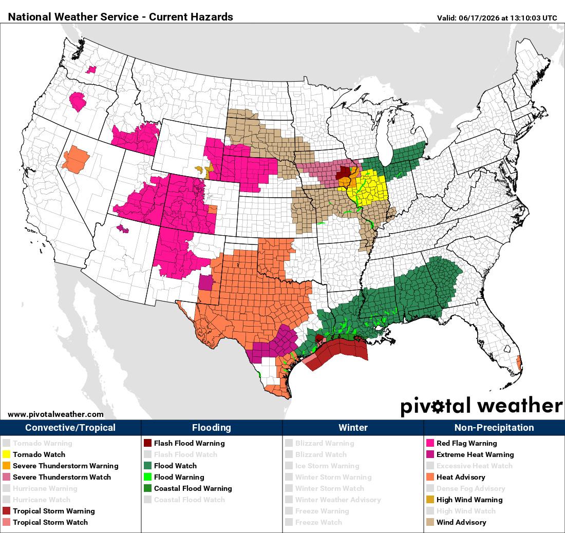
PTC One Update
The center of circulation associated with Potential Tropical Cyclone (PTC) One at 7 am was estimated to be just east of Port O Connor. The latest NHC forecast brings it up to near Galveston Island early this afternoon and then northeast into Louisiana tonight, perhaps as a tropical depression or storm. It is technically not a tropical depression or storm yet, but is already producing wind gusts to near tropical storm force at some mesonet sensors near Freeport and Galveston.
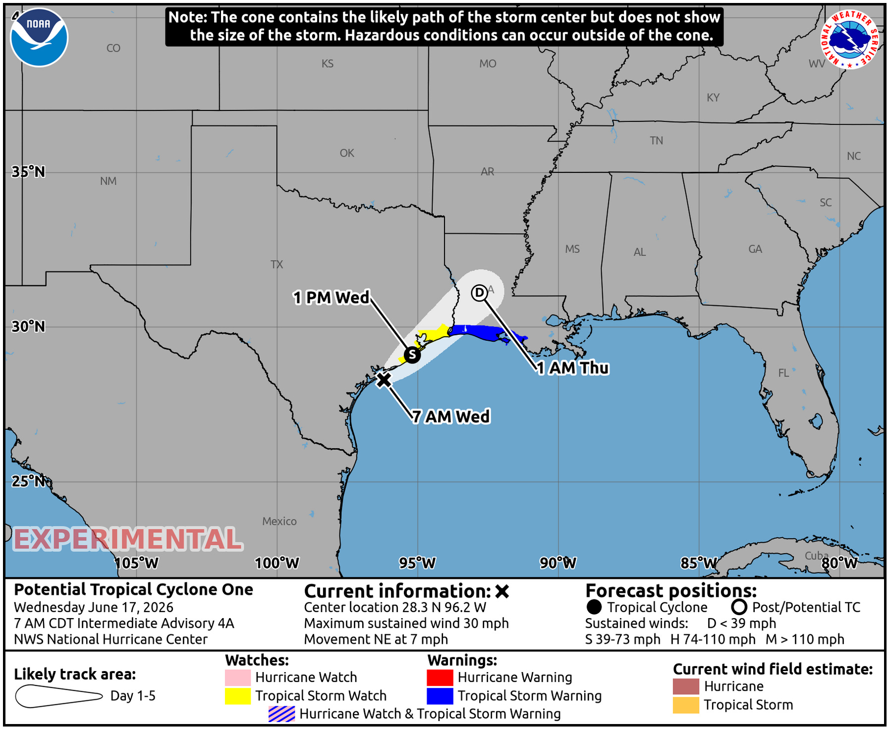
This system will bring wind gusts of 35 to 45 mph near the coast as it works its way northeastward along the Texas coast, with rain, moderate to heavy at times, in advance of this surface ciculation. Will also see elevated surf and tides, with perhaps beach erosion and minor coastal flooding.
Past Rainfall/Flood Threat
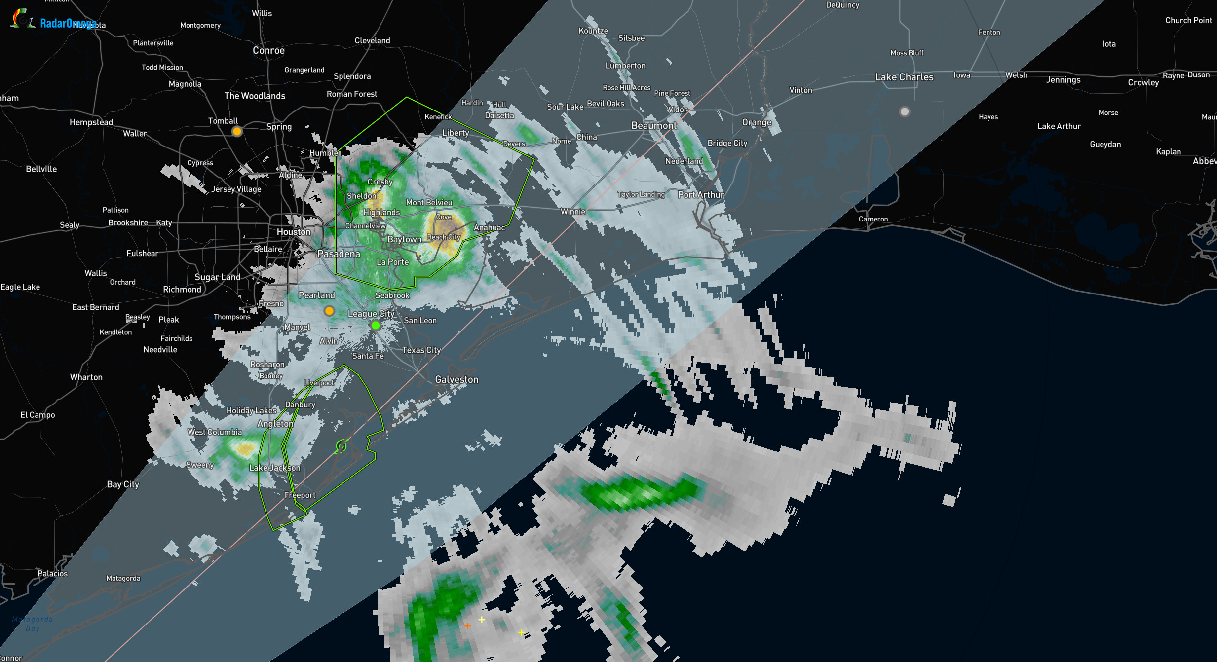
The map below shows radar inferred rainfall for past 12 hours. Southern Brazoria County stands out with a bullseye. MRMS estimates show 12 hour rainfall close to 7 inches.
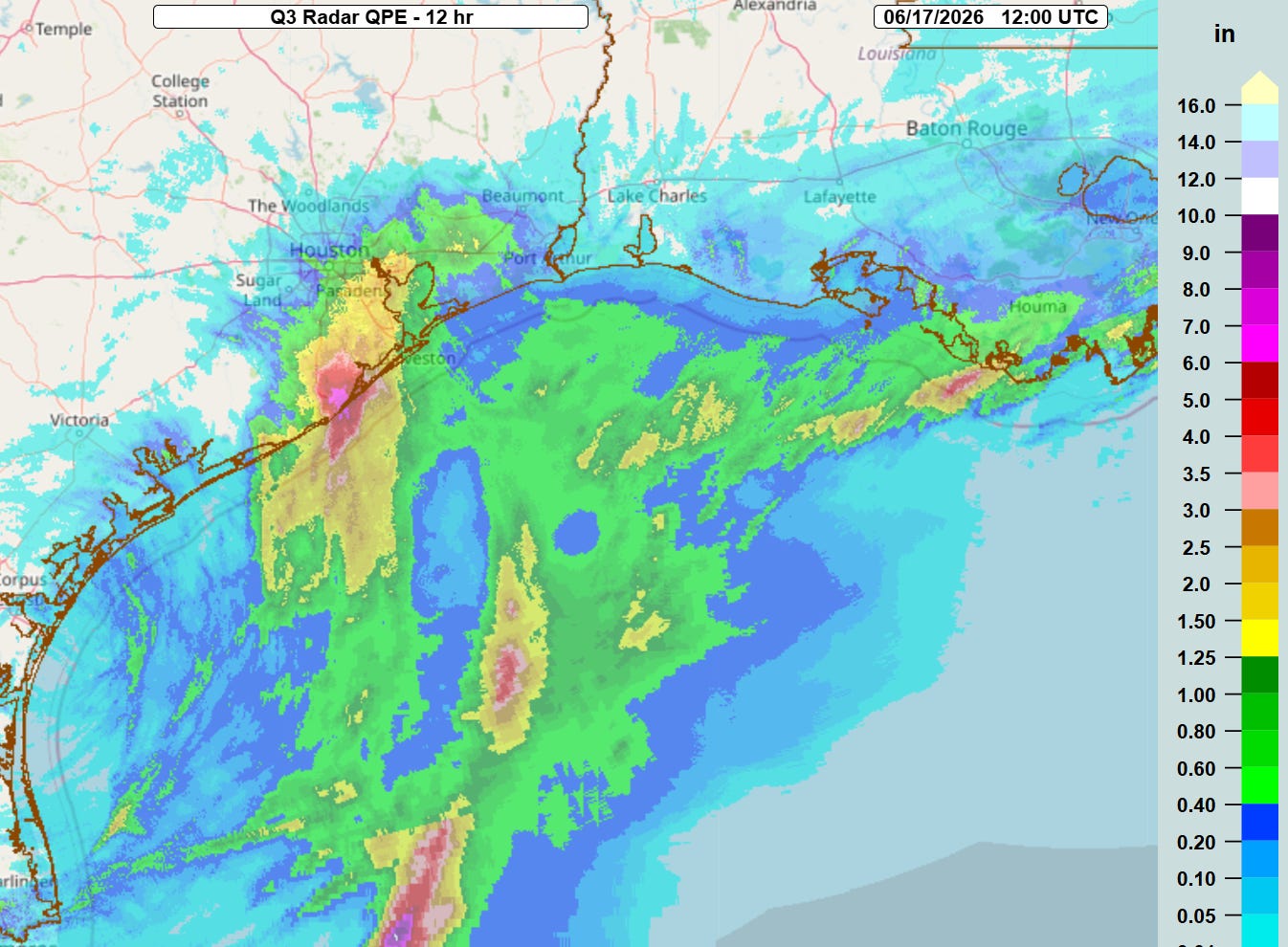
This brings storm total radar estimates close to 1 foot for that area. NWS has a Flash Flood Warning in effect for that area.
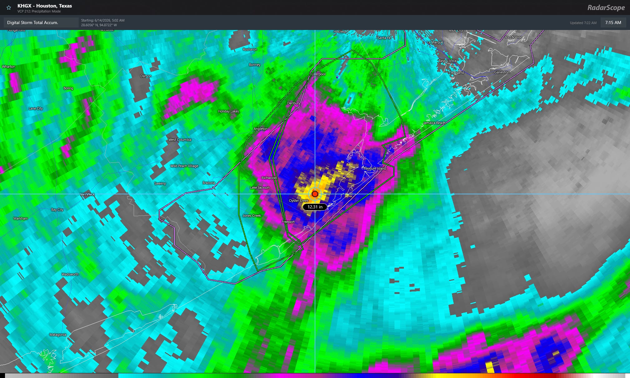
The radar animation from HGX Houston/Galveston radar is shown next. One can see rain pushing well inland with it falling moderate to heavy at times.
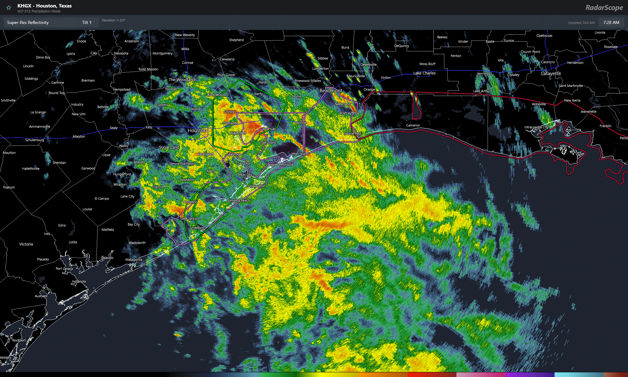
The one hour rain rates are now (as of 745 am) maximized over the east side of Harris County over into Chambers County. The image below shows the green polygons and one hour radar inferred rainfall as of 750 am today. A new Flash Flood Warning was issued for East Harris over into Chambers as shown.
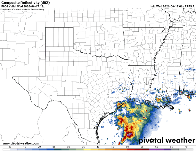
The rain will shift east with the disturbance as we go though the day with heavier rains tapering off around Houston this afternoon, and around Beaumont, Pt. Arthur this evening. The forecast radar from 06Z run of RRFS is shown to illustrate qualitatively how things are likely to evolve. The loop runs from this morning until Friday midday. One can see the heavy rain and flash flood threat should end from west to east today with somewhat of a break tomorrow, then perhaps a thunderstorm complex working its way down from the north on Friday (with some wind/severe threat).
Extreme Heat
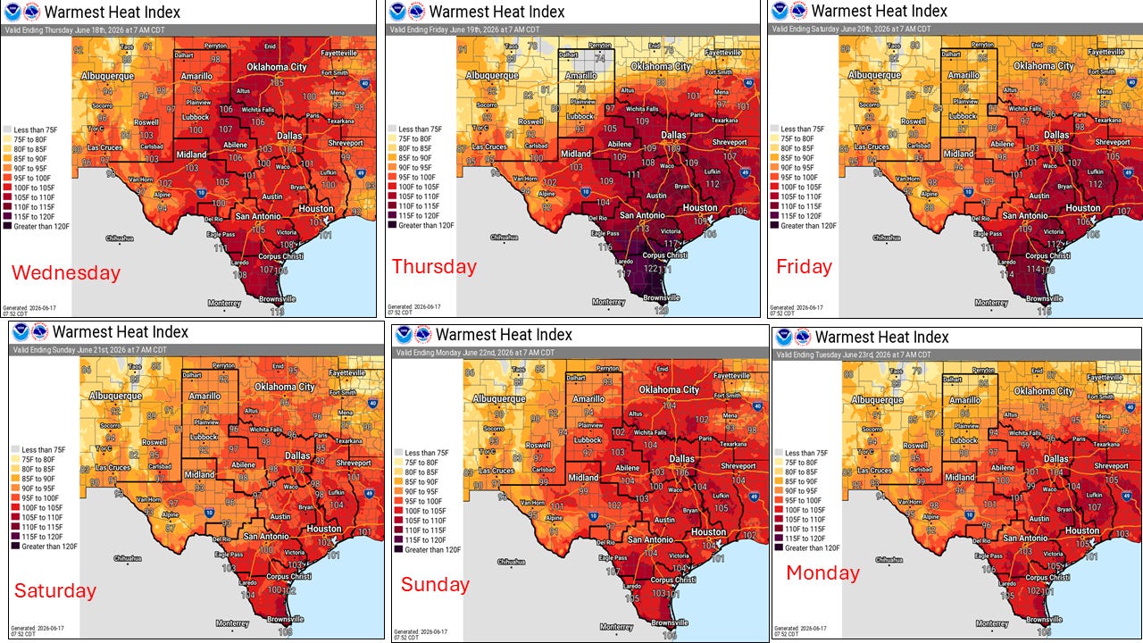
Much of the focus this week so far has been on the flash flood threat but we don’t want to lose sight of what may be ultimately more dangerous and deadly, the extreme heat and humidity we are facing here in Texas for much of this week. The maps below show maximum heat indices for the next several days. Note many areas will be above Heat Advisory Thresholds and perhaps Excessive Heat Warning levels. Heat Index Values of 110F will be common and up to 120F over South Texas! These are dangerous levels for those that work outdoors and for other vulnerable populations, not to mention all the outdoor activities and international visitors to the area for the soccer matches who might not be acclimated to the heat.
There are plenty of heat safety tips and infographics here: https://www.weather.gov/wrn/heat_infographics. Be sure to share with your friends, family, coworkers, etc.