Severe Weather Outbreak Expected for Southeast and Mid Atlantic Today

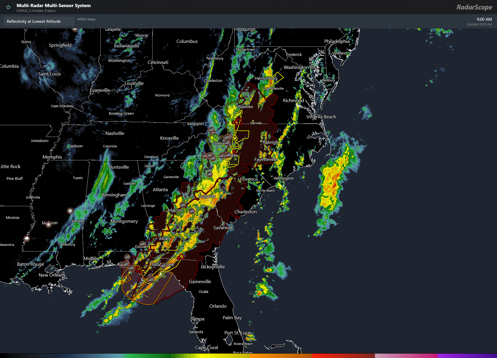
Conditions are in place for an outbreak of severe weather across the Southeast and Mid Atlantic today and this appears to be already underway. The image below is a map showing latest radar composite as of 10 am EDT Monday morning, also showing a tornado watch (in red shading) and various severe thunderstorm and tornado warnings (smaller yellow and red polygons respectively).
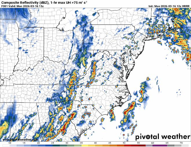
This mornings 12Z run of the HRRR model (shown from now to midnight tonight EDT) shows how the radar may evolve generally with lines of storms progressing east and northeastward from where they are now, with potential for cells developing out ahead of the main line. Damaging winds are a good bet. Potential also exists for development of tornadoes, especially in any discrete cells that develop out ahead of the line and/or with any circulations/mesocylones within the lines of storms.
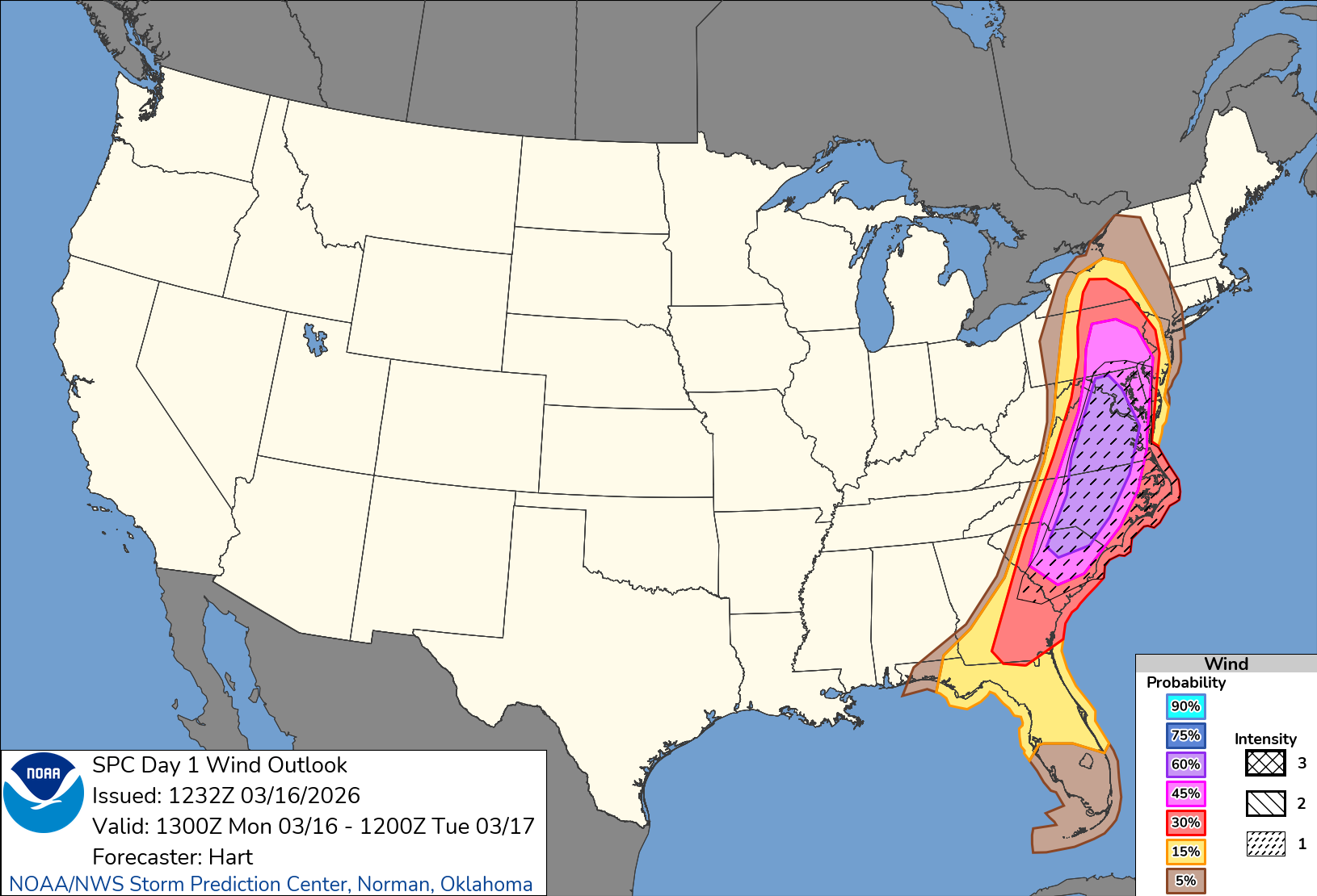
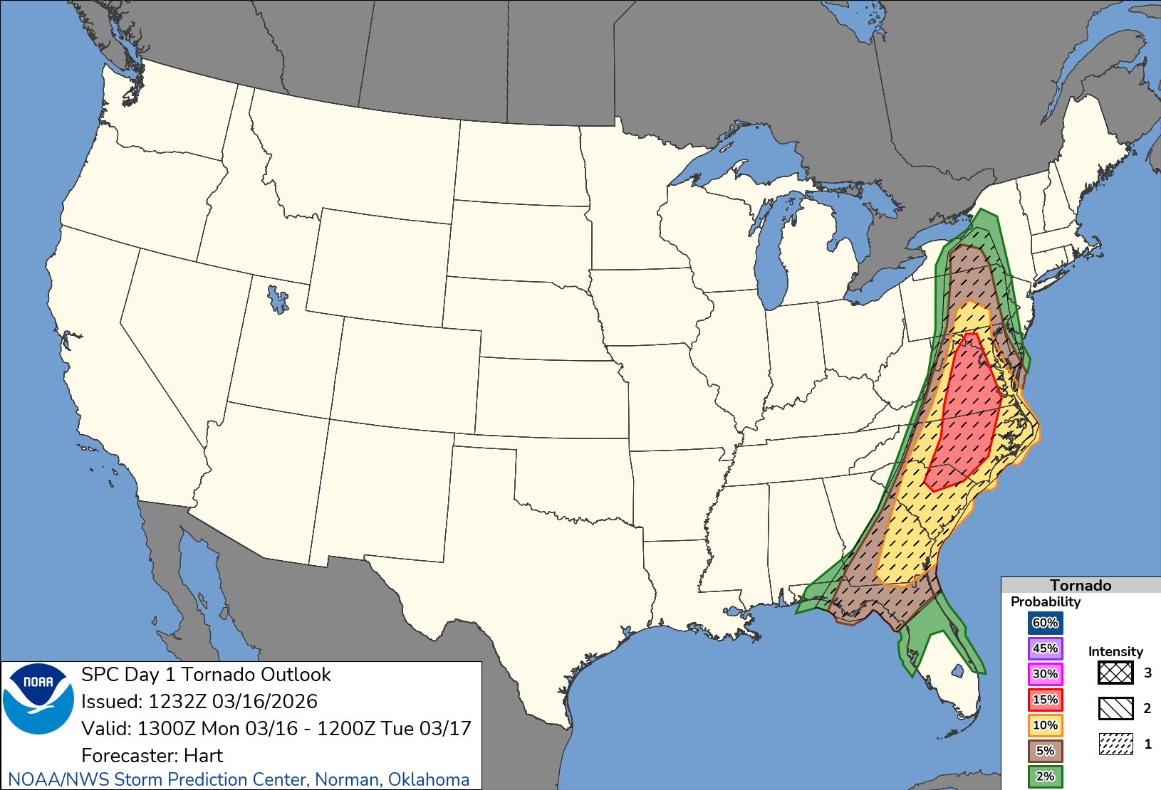
Here are the latest talking points and the convective outlooks from the NWS Storm Prediction Center. Note the very large Enhanced (level 3) and Moderate (level 4) areas.
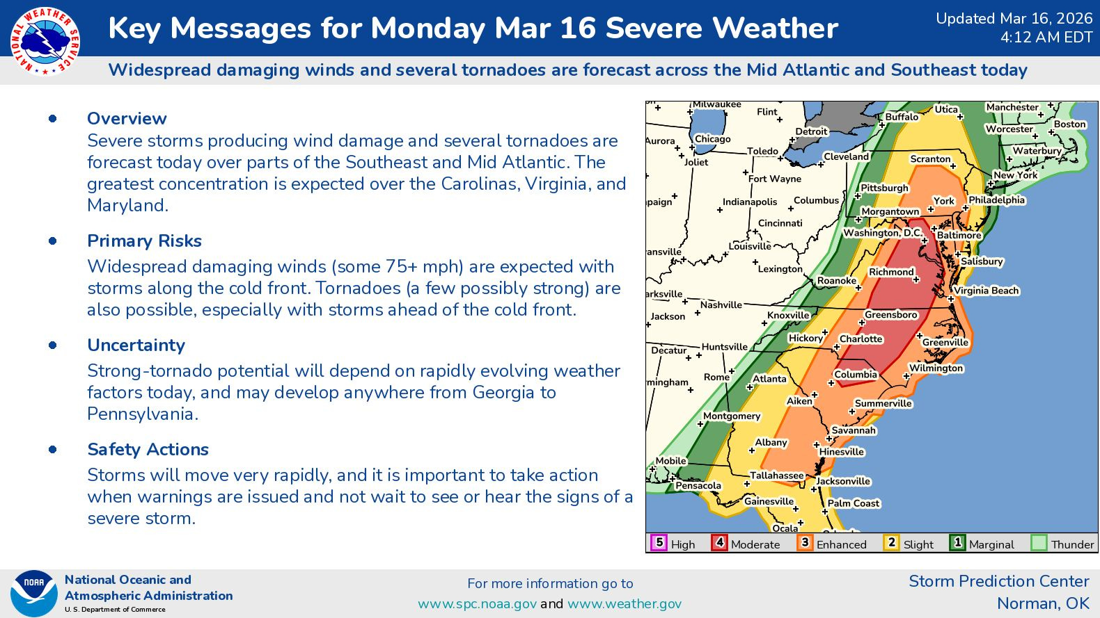
The hazard specific maps are shown below. Probabilities are defined as chances of a damaging winds/tornados within 25 miles of a point. The intensity hatching in this case suggests potential for 74+ mph winds and/or EF2 tornadoes.
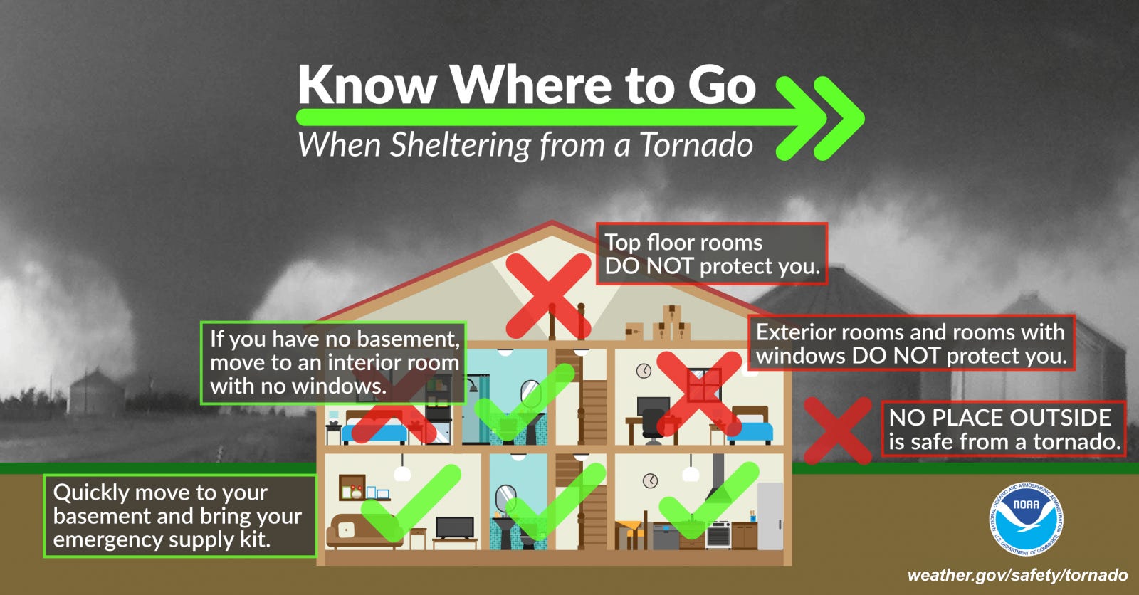
Stay tuned for updates, have multiple ways to get warnings. If a warning is issued for your area, take shelter. Its best not to be on the road during the warning, better to be inside a sturdy shelter. I’ve included a couple of reminder infographics from NOAA/NWS below.