
Low Pressure System and Associated Cold Front to Bring Extreme Weather to U.S. Today and Tomorrow

National Overview
An intense extratropical cyclone/low pressure system will work its way across the Great Lakes today, then into Eastern Canada, dragging a strong cold front with it. Nationally, this will bring snow and blizzard conditions for the Northern Plains and Great Lakes, and widespread windy conditions over much of the nation. The loop below shows the general surface evolution form the 06Z run of the EMCWF model, including surface pressure and forecast precipitation type and rate.
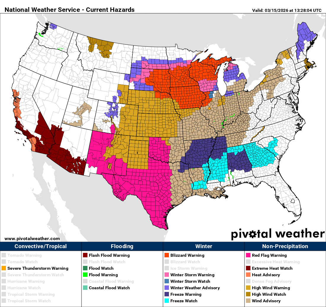
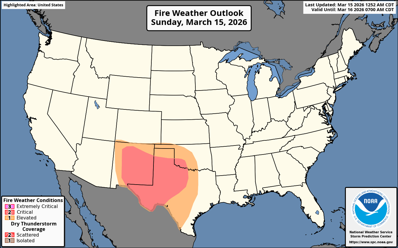
The latest watch/warning/advisory map from the National Weather Service is shown below. Note the extremes on the map with a very large Blizzard Warning shown in red over the Northern Tier, a variety of wind related highlights over the center of the country (High Wind Watches/Warnings and Wind Advisories), fire danger related headlines over much of Texas, Oklahoma and New Mexico (Red Flag Warnings), not to mention Extreme Heat Watches over the Southwest and Freeze Watches and Warnings over the Southeast!
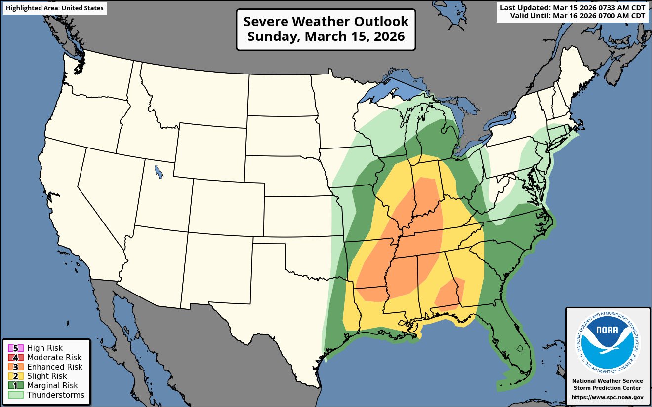
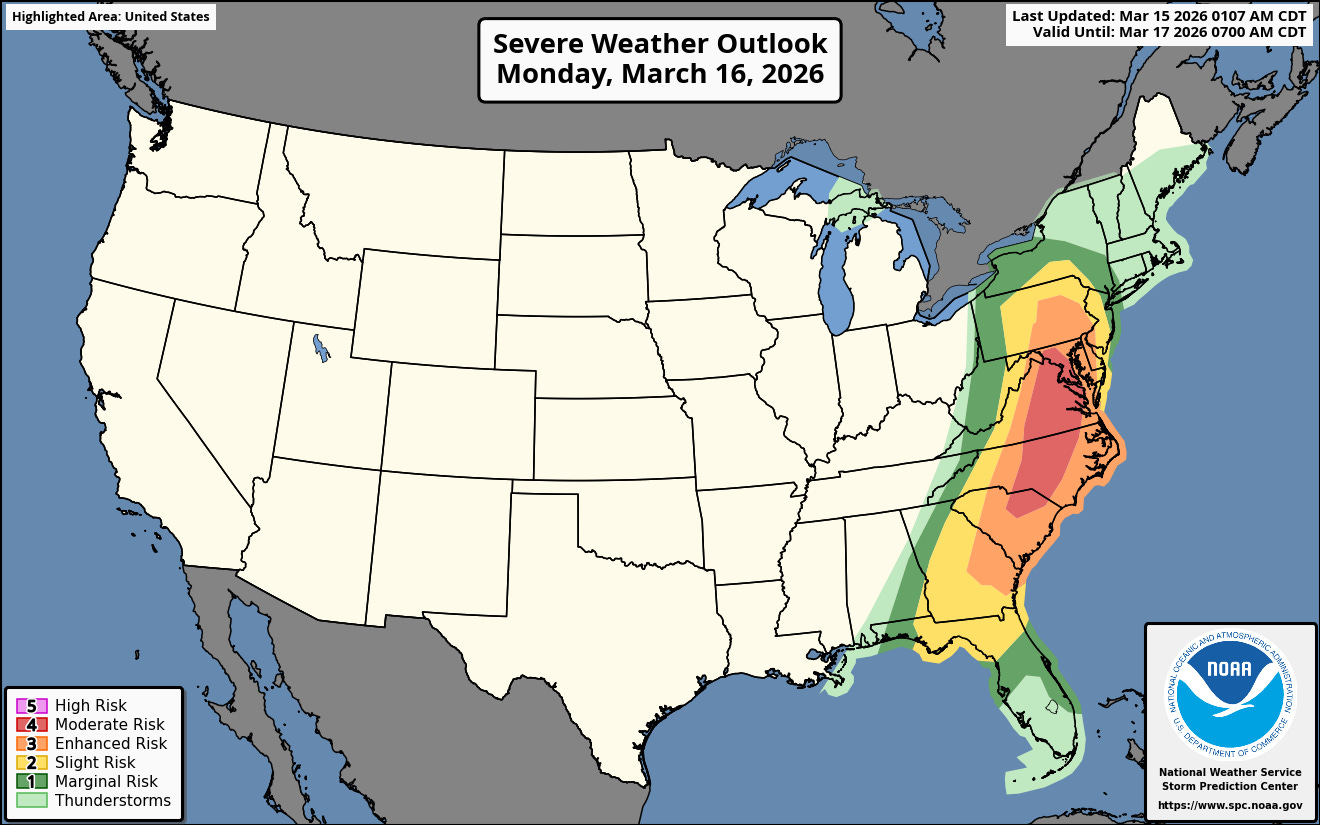
On top of all that, there is a level 3 Enhanced risk of severe thunderstorms and tornadoes today and a fairly rare Day 2 level 4 risk tomorrow ahead of this strong cyclone/cold front as shown by the categorical outlooks for today and Monday.
A loop on of the 12Z run of this HRRR this morning shows the general radar evolution starting around noon today and continuing through Monday evening. The line of storms with the front will likely contain fairly widespread damaging wind with the possibility of tornadoes both with the line and in cells out ahead of the line the next few days.
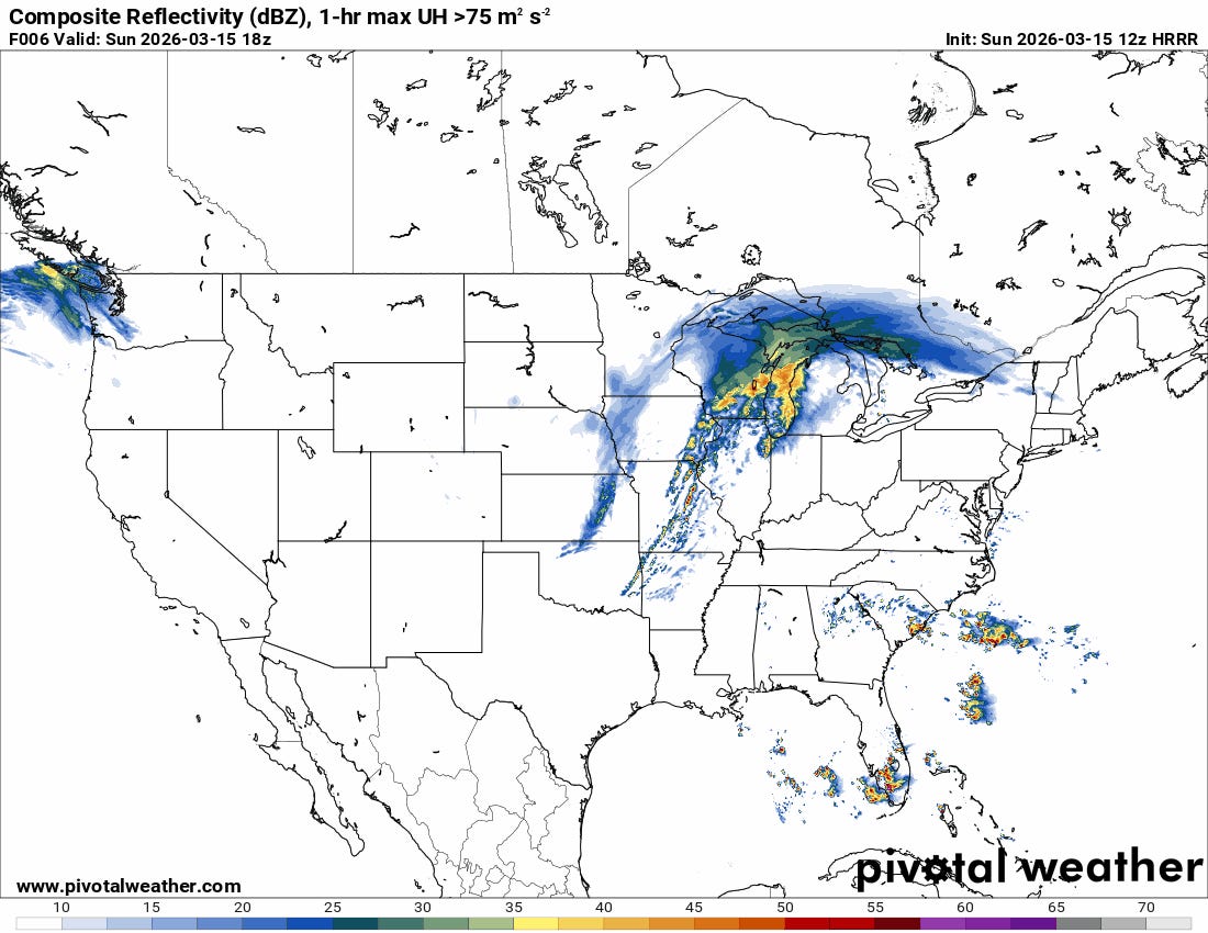
Finally note the forecast wind gusts from the same model run shown below. One can see the vast area with gusts in the 40 to 50+ mph range behind the frontal zone and around the cyclone.
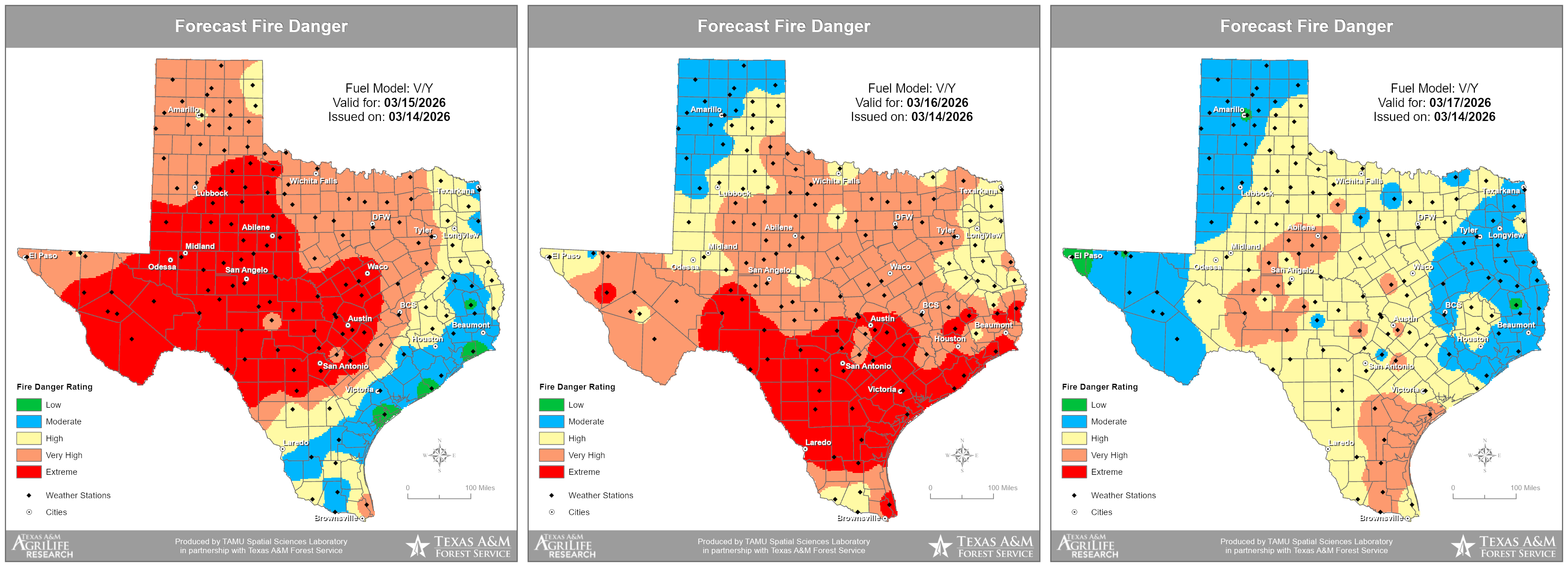
The high winds are contributing to whiteout conditions due to snow and blowing snow in the blizzard warned area and to extreme fire danger over West Texas and New Mexico.
Stay tuned to the National Weather Service and other trusted weather sources for updates!