
Looking Ahead to Weather This Week and Update on Tropics, August 18th

Summary
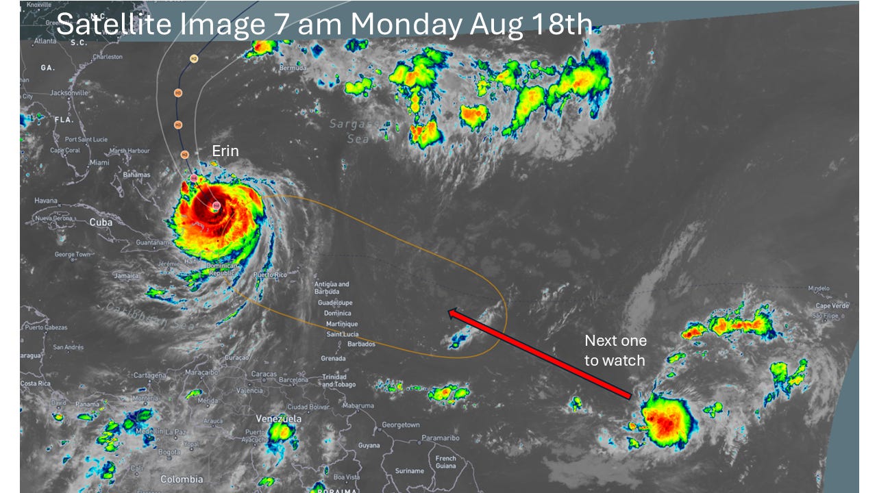
Tropics are active this morning! Satellite image below shows both Hurricane Erin, now a Category 4 major hurricane, and a tropical disturbance behind it which has a medium chance of developing into a tropical cyclone over the next 7 days.
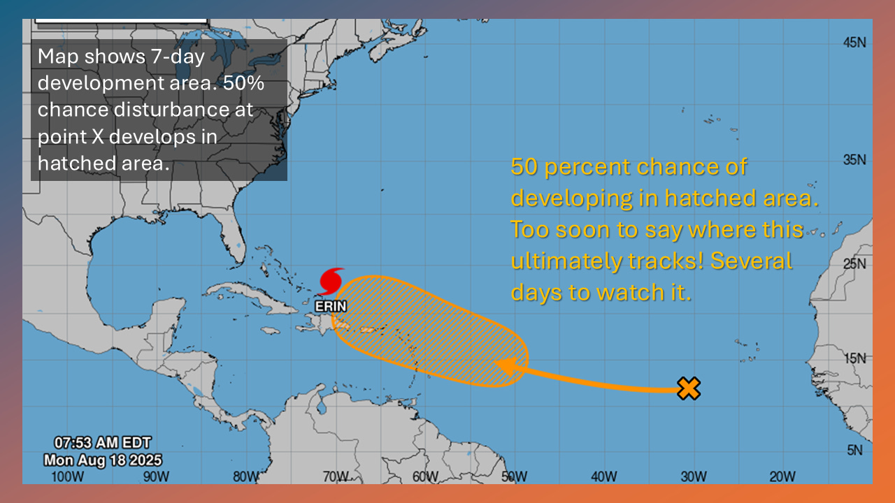
Hurricane Erin forecast to track between the NC Outer Banks and Bermuda over the next 3 days. Will generate gusty winds, high surf and rip currents along the U.S. East Coast and high seas, dangerous winds over the Western Atlantic.

Another disturbance may form behind Erin. Now given a 50 percent chance of developing. Too soon to speculate where that disturbance may go should it develop. It could recurve or take a more westerly heading. Will have several days to watch.
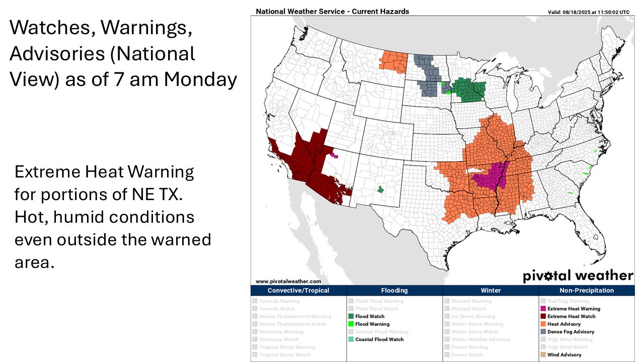
Looking at weather conditions nationally and across Texas, main story will be the heat and humidity across much of the U.S. There will be a flood risk today across portions of MN, WI and IL.
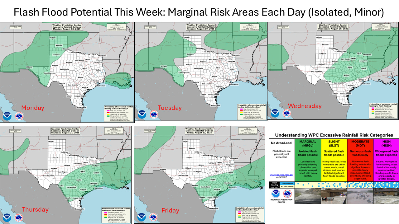
For Texas will have a fairly typical summertime pattern with this week with hot, humid conditions and thunderstorm chances most days. Thunderstorms in general not expected to be severe. There will be an isolated flood risk areas each day across portions of Texas where heavy downpours may produce localized, mainly minor flash flooding. The following map shows marginal flash flood risk areas each day this week.
Subscribe to this weather blog for updates. Also can follow on Facebook (here) and Twitter (here). You are welcome to share this weather blog post with those you think would be interested. As always follow your local NWS office and the the National Hurricane Center and other trusted sources!