
Hurricane Melissa to Bring Devastating Impacts to Jamaica, Portions of Cuba, Haiti
Melissa Now a Category 5

Hurricane Melissa is now a category 5 hurricane having undergone rapid intensification as predicted over the weekend. The hurricane is drifting toward the west at 3 mph at last advisory. A turn toward the NW then N is expected over the next 24 hours. Shown below the visible satellite image as of 747 AM Monday Oct 27th.
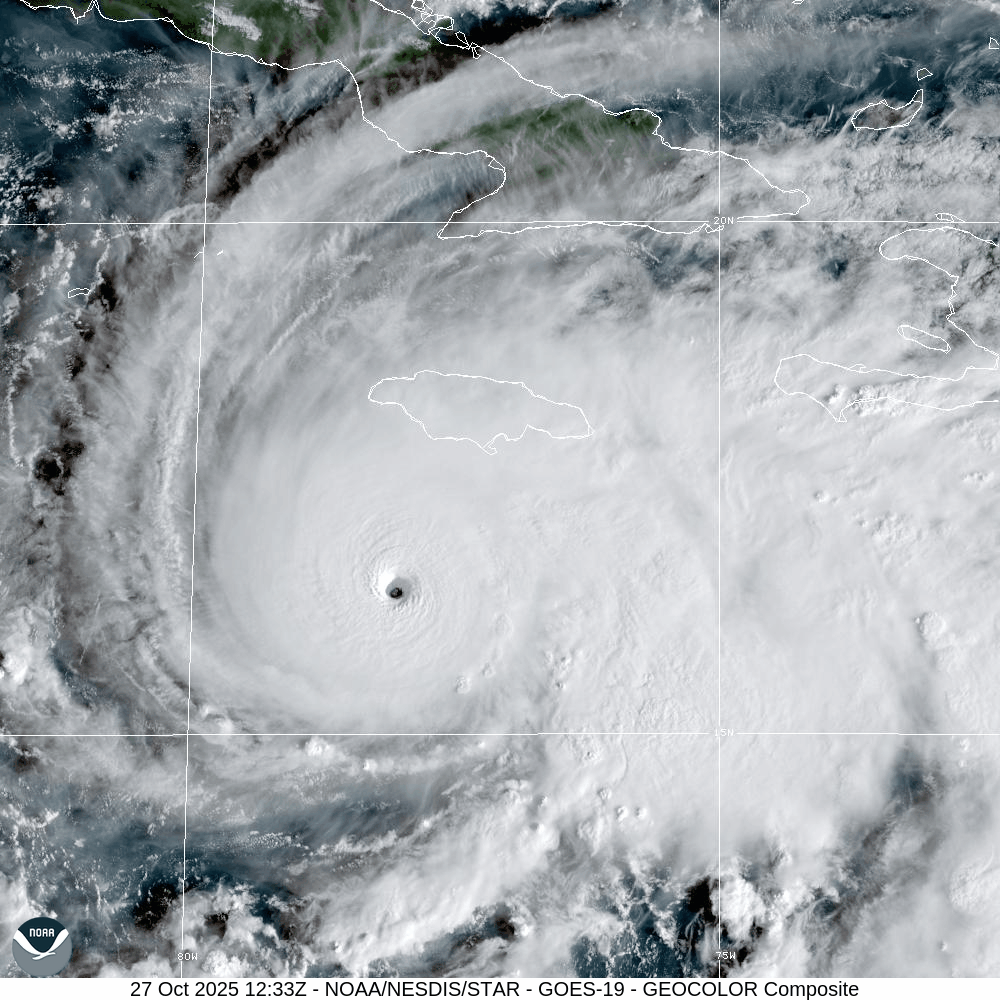
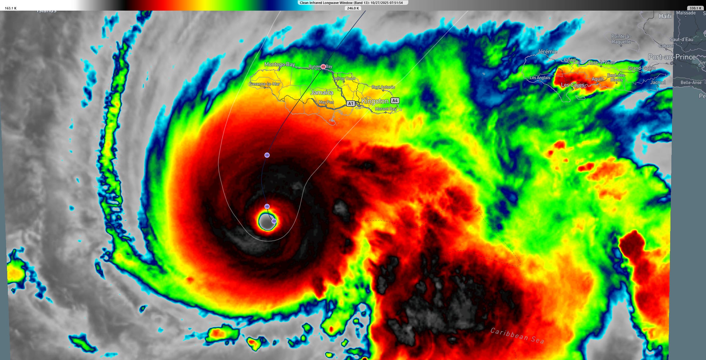
Both the visible (above) and infrared imagery (below) show evidence of a very intense hurricane, rated as a category 5 on the Saffir Simpson Hurricane Wind Scale, the highest rating on that scale. The intensity and slow movement of the storm, plus the track of the center directly over Jamaica suggest a long duration of extremely damaging winds and heavy rainfall/flooding for the island.
The map below shows the 3-day track for Melissa. Note again the very low movement and intensity of the storm as the center crosses Jamaica and Eastern Cuba.

Widespread rainfall of 20 to 30 inches is forecast but local amounts will be even higher given the slow motion and the rainfall rates being enhanced by the mountainous terrain on the island. Once it crosses Jamaica, then Cuba, the hurricane is forecast to gradually accelerate N then NE as it gets picked up by
![[Image of rainfall potential]](https://substackcdn.com/image/fetch/$s_!j2ov!,f_auto,q_auto:good,fl_progressive:steep/https%3A%2F%2Fsubstack-post-media.s3.amazonaws.com%2Fpublic%2Fimages%2Fd6784ed7-616f-4f31-91d3-8526cd2d2532_3300x2550.gif "[Image of rainfall potential]")
The map below shows the mountainous terrain, elevation of Jamaica.

The National Hurricane Center (NHC) captures the expected impacts to Jamaica and other Caribbean Islands in their key messages statement including destructive winds, catastrophic flooding, landslides, storm surge, etc.
Follow NHC messaging/warnings for Melissa here:
https://www.nhc.noaa.gov/graphics_at3.shtml?start#contents
![[Key Messages]](https://substackcdn.com/image/fetch/$s_!OhF7!,f_auto,q_auto:good,fl_progressive:steep/https%3A%2F%2Fsubstack-post-media.s3.amazonaws.com%2Fpublic%2Fimages%2F3f939663-b600-4222-8c98-c5ca1c011c6b_897x736.png "[Key Messages]")
Once it crosses Jamaica, then Cuba, the hurricane is forecast to gradually accelerate N then NE as it gets picked up by cold front and an associated upper trough dipping down into the tropics this week. This same cold front will cross Texas on Tuesday, bringing much cooler, drier conditions locally to Southeast Texas starting late Tuesday and continuing through the week.