
Another Thunderstorm Complex to Bring Rain Today to Southeast Texas

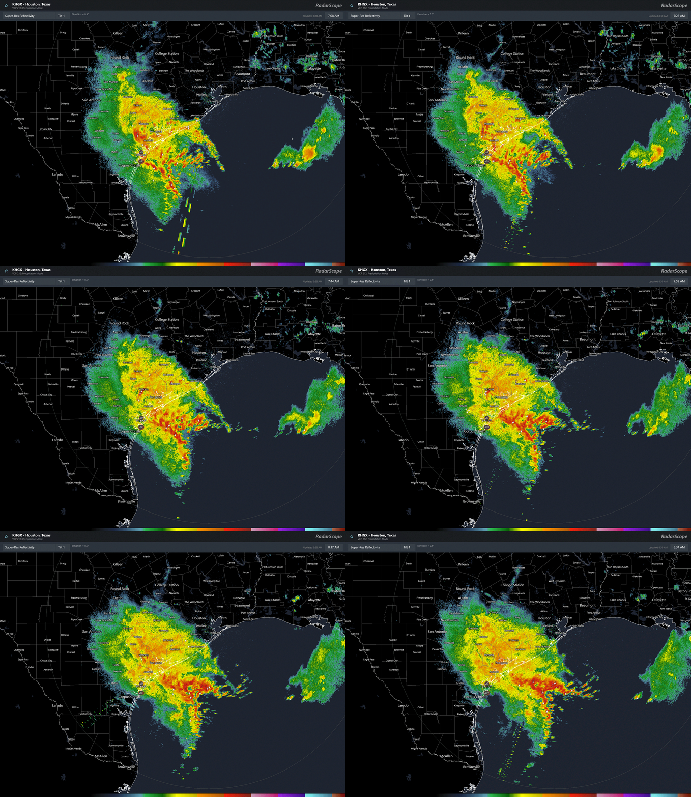
For the third day in a row, the morning radar features a complex of thunderstorms, aka a mesoscale convective complex (MCS), working its way up the Texas coast. Shown below the radar loop from the HGX NWS Houston/Galveston radar as of 840 am Thursday.
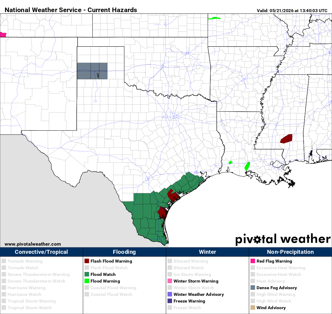
This MCS has brought significant rainfall to the Coastal Bend region leading to Flash Flood Warnings for the counties shown in red on the watch/warning map below. Note also the Flood Watch in green. Those areas received a good amount of rain from yesterdays MCS, so this additional rain could potentially lead to flooding in the watch area.
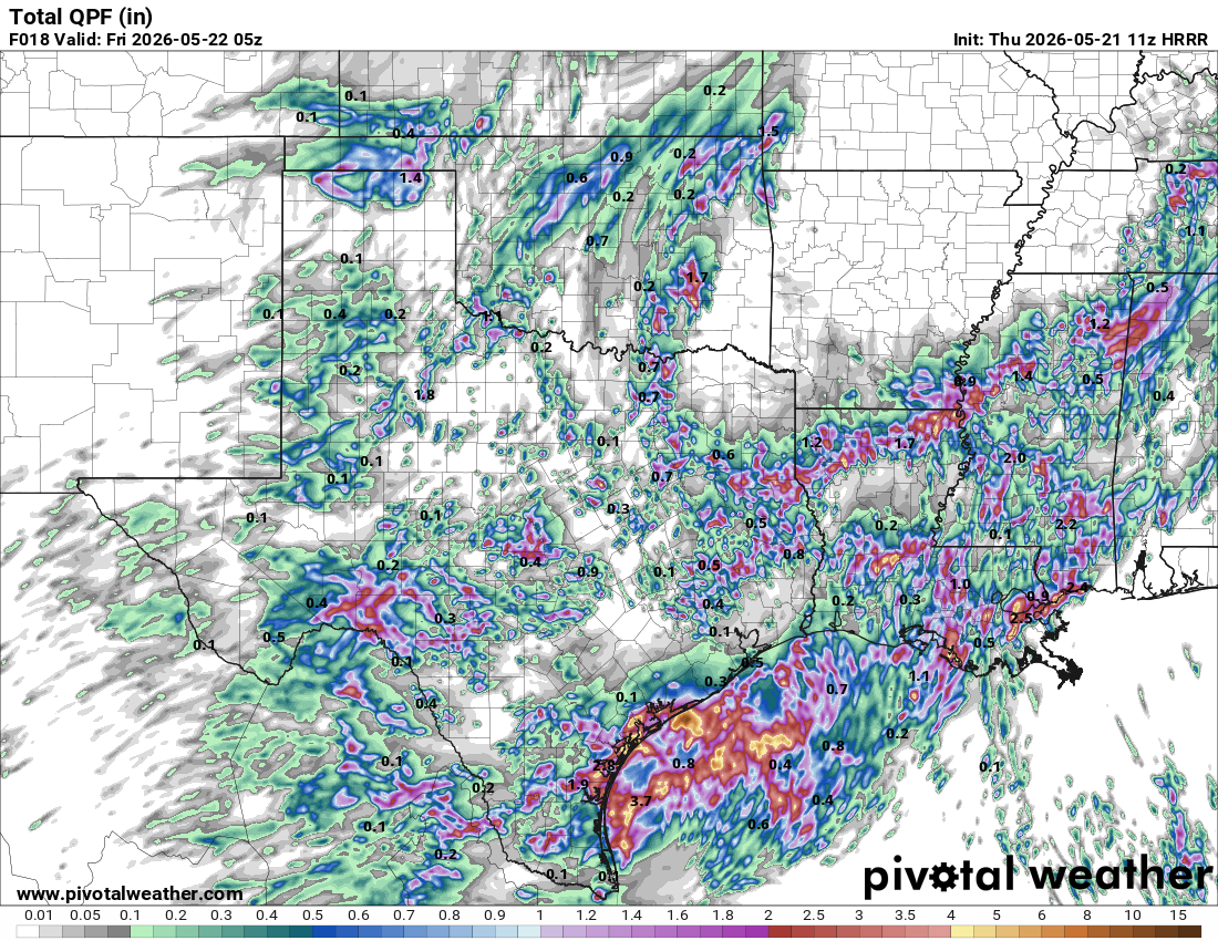
From here on out the rain from this MCS should be concentrated along the coast and offshore. The 18 hour rainfall totals from the most recent run of the HRRR shown this well. Note, in this model run, isolated higher totals scattered here and there but with the more widespread rain from this thunderstorm complex heading offshore. This is consistent with recent radar trends. It will still bring rain inland, especially I-10 on south this morning, but not the heaviest rain.
Going forward, still looking at daily thunderstorm chances for the next several days. Conditions seem especially favorable Saturday for perhaps more significant rainfall. Key for flood threat will be where the higher rain rates set up in any slow moving parts of these storm complexes. Details for this remain uncertain as we get farther out in time.