
Active Spring Severe Weather Pattern Across the U.S.; One Year Anniversary of Houston Derecho
Today Marks One Year Anniversary of Derecho that Impacted Greater Houston

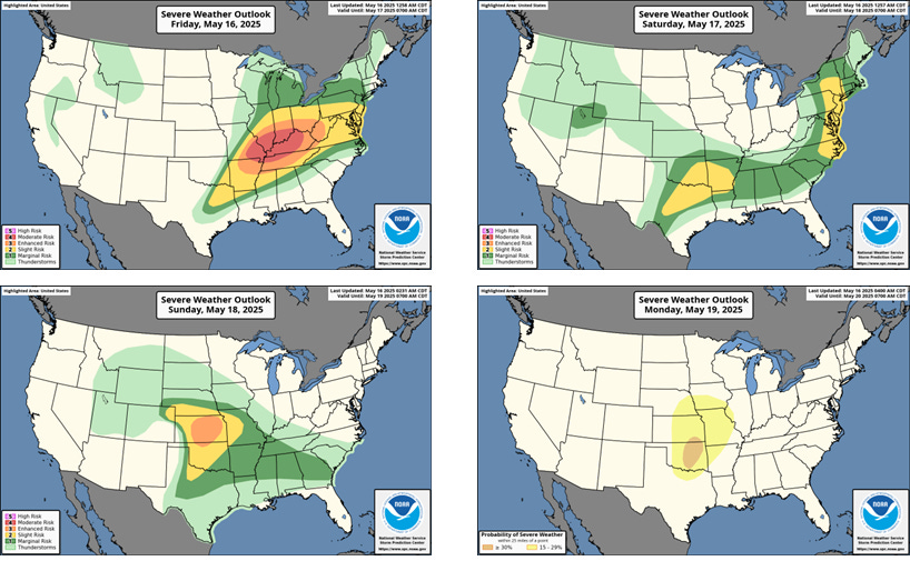
Conditions are right for numerous rounds of severe weather including tornadoes, large hail and damaging winds The main risk areas for the next 4 days are shown here as indicated by NOAA/NWS Storm Prediction Center (SPC). Note the large moderate risk area today (upper left image: level 4 on a scale of 1 to 5) over portions of KY, IN, IL, MO, AR and TN, and the very large risk area overall. For Texas, a slight risk extends into N and NE TX today.
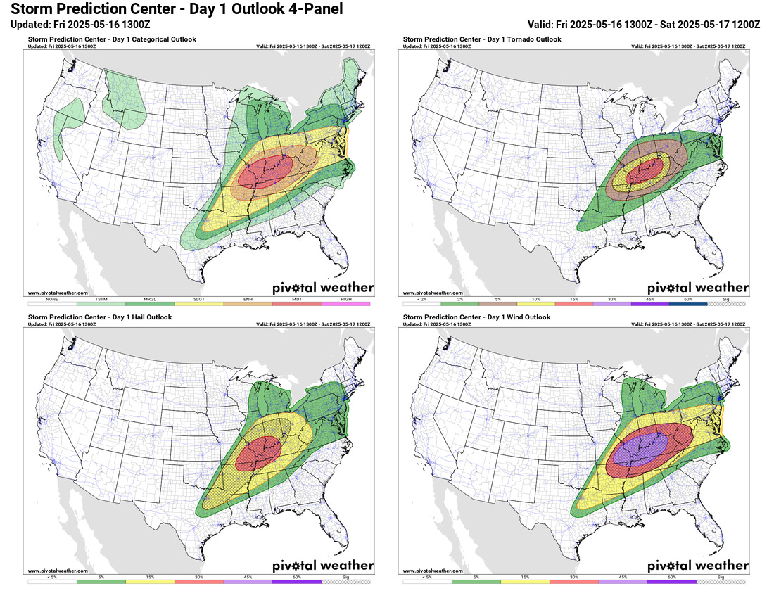
The next set of images shows more detailed information for each of the main severe thunderstorm hazards for today, including risk of tornadoes, large hail, damaging winds. Note the hatched areas in these images. In those areas SPC is especially concerned about “significant severe.” This is defined as wind gusts of at least 75 mph, hail at least 2 inches in diameter, tornadoes rated EF2 or greater. You can see large hatched areas for all hazards. The numbers on the map are point probabilities indicating the chance of a severe report in that category within 25 miles of a point.
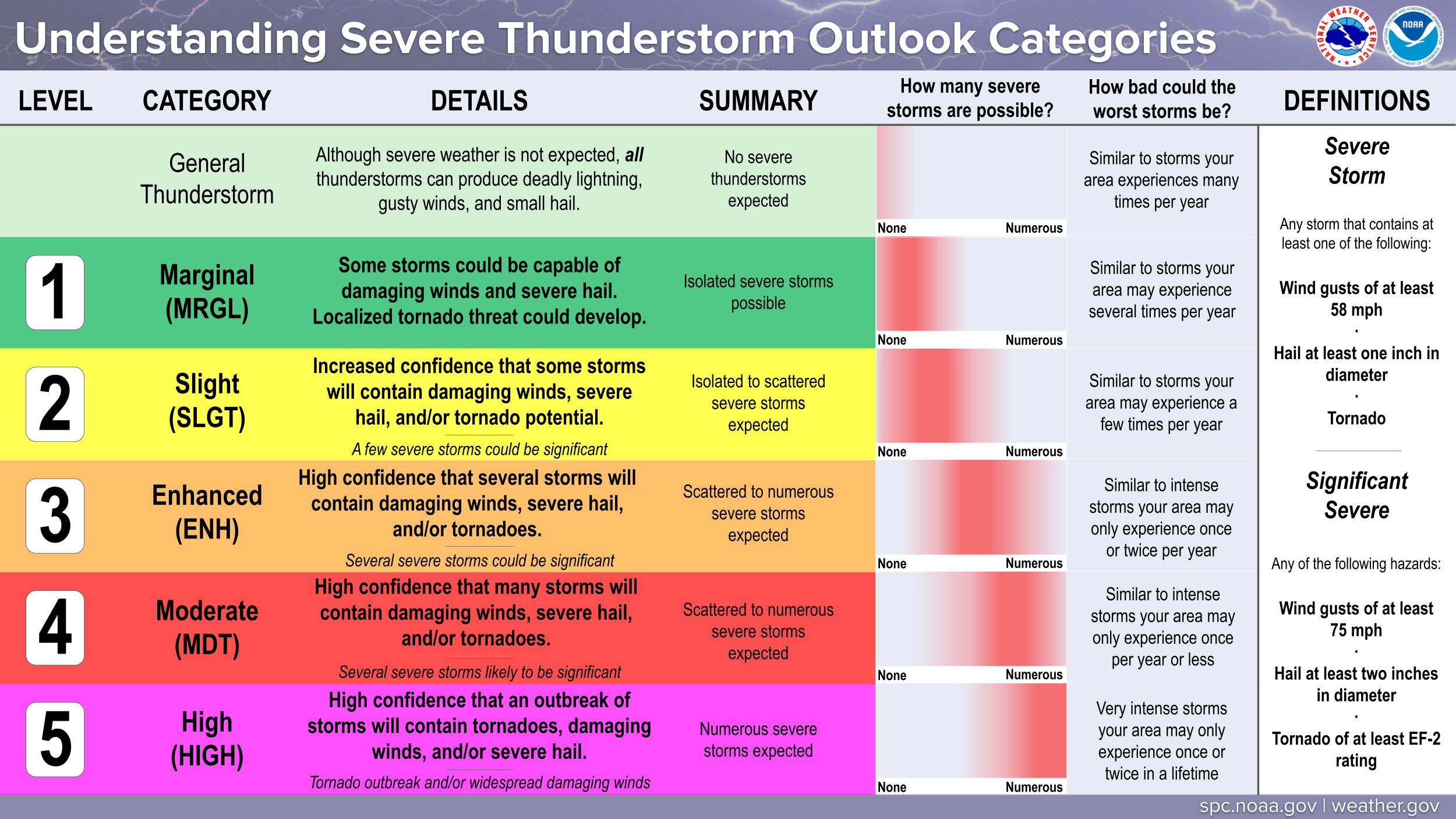
A review of what the different categories represent is shown here.
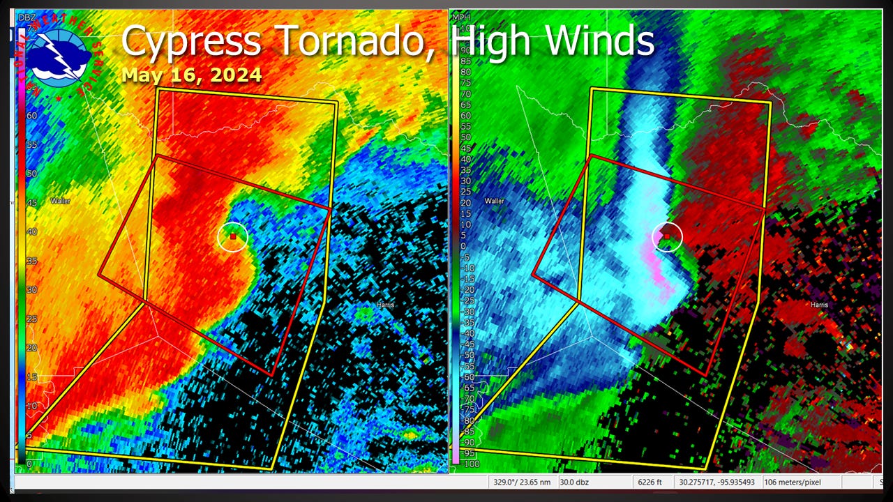
Today marks the 1 year anniversary of derecho that brought severe winds and isolated tornadoes to the greater houston on May 16th, 2024. Click on the image below to see a radar loop of this line of storms.
The radar image below shows a snapshot of the look as an EF1 tornado was occurring in Cypress (near the red dot on these images). The left panel is the familiar reflectivity image showing different intensities of rainfall within the storm. On the right hand side we see the radial velocity of targets (mainly raindrops) moving toward and away from the radar.
Feel free to share this weather blog if you find it interesting and to subscribe if you like. It’s still a work in progress, feedback is welcome.
Nice post Dan!
From a former co-worker in NC.